The Jurassic Lias Clay underpins much of Northampton, but it's rarely uniform. Glacial tills, pockets of Northampton Sand, and lenses of alluvium along the Nene Valley create a patchwork that catches out standard desk studies. In our experience, the real risk sits at the interface between the weathered clay and the competent bedrock, where SPT refusal can jump from 15 to 50 blows within a metre. We run the standard penetration test to BS EN ISO 22476-3, but the value comes from reading the split spoon sample alongside the blow count; a grey-blue stiff clay with N=22 tells a different story than a brown silty clay with the same number. Northampton's Victorian and Edwardian building stock adds another layer of caution, because many structures pre-date any formal ground investigation, and the made ground in the town centre can be surprisingly deep.
In Northampton, the difference between N=15 and N=25 in the Lias Clay can change your foundation design from a simple strip footing to a reinforced raft.
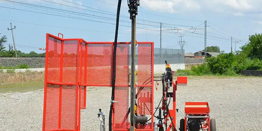
Process overview
Local context
BS EN 1997-1:2004 requires that the ground investigation be 'sufficient to establish the ground properties for all limit states'. In Northampton, the limit state that most concerns us is bearing failure in weathered Lias Clay, particularly where a conservative N60 has been over-interpreted without considering the soil's sensitivity. We have seen sites near the Nene floodplain where SPT blows of 12 to 16 in a silty clay were taken as adequate for a two-storey extension, only for settlement cracks to appear within two years. The trigger was seasonal moisture variation softening the clay to a depth of 1.8 metres, something the original N value did not capture because the test was done in a dry summer. We now recommend coupling the SPT with moisture content profiles and, on larger schemes, a few CPTu soundings to track pore pressure dissipation. A single SPT per borehole at 1.5 metre intervals is the minimum; in variable ground, we tighten that to every metre and add a trial pit near the surface to log the desiccation crust. Cutting corners on the investigation depth is the most expensive mistake you can make in Northampton's clay.
Reference standards
BS EN ISO 22476-3:2005+A1:2011, BS EN 1997-2:2007 (Eurocode 7 – Ground investigation and testing), BS 5930:2015+A1:2020 (Code of practice for ground investigations)
Additional services
Borehole SPT with rotary drilling
Full-depth investigation through made ground, glacial deposits, and into the Lias Clay using hollow stem augers or rotary coring. We log every split spoon recovery and record N values per 150 mm penetration interval, corrected for energy ratio.
N60 energy correction and liquefaction screening
We apply overburden, rod length, and hammer energy corrections to give you N1(60) values. In the Nene Valley sands, we run the Youd-Idriss procedure to rule out liquefaction potential for structures falling under BS EN 1998-5.
Combined SPT and laboratory testing package
We pair field SPT data with index testing (PI, particle size distribution) and undrained shear strength from triaxial compression, so you get a single consistent geotechnical design report aligned with EC7 Design Approach 1.
Typical parameters
Top questions
How much does an SPT investigation typically cost for a single house plot in Northampton?
For a residential plot requiring two boreholes to 8 metres depth with SPTs at 1.5 metre intervals, you should budget between £450 and £600 plus VAT. The final figure depends on access constraints, whether we need hollow stem augers through gravel, and how many samples go to the laboratory for classification testing.
How deep should SPT boreholes go for a two-storey extension on Lias Clay?
We recommend a minimum depth of 6 to 8 metres below ground level, or until you reach three consecutive SPT intervals with N60 above 30 in the intact clay. Stopping at 3 metres often misses a weathered zone that controls settlement, and in Northampton the desiccation crust can extend deeper than you might expect.
Do I need SPT testing if the site has historic borehole logs from a neighbouring property?
Historic logs give you a useful starting point, but they rarely capture the variability we see across Northampton's geology. Made ground thickness, sand lenses, and the depth to competent Lias can shift significantly over 30 metres. We always run at least one verification borehole with SPT to tie the old data to current EC7 requirements and to check for any undocumented fill.