Northampton sits on a varied geology that catches out even experienced contractors. The town centre, roughly 70 metres above sea level, overlies Northampton Sand Formation ironstone beds with layers of Lias Clay beneath, while the Nene Valley corridors bring thick alluvial deposits into the mix. When you open a deep excavation near the railway station or alongside the dual carriageways of the A45, you are cutting through materials that behave very differently from one bench to the next. We have seen groundwater appear where borehole logs said it would not, and we have seen retained cuts move more than the design allowed simply because the site investigation missed a thin silt lens. Our geotechnical excavation monitoring service gives you the data stream that turns those surprises from emergencies into manageable events, triaxial test parameters validated against actual in-ground response and inclinometer readings tied back to the retaining wall design assumptions so the temporary works coordinator knows exactly what margin remains.
Good monitoring does not stop a wall from moving—it tells you how much movement is left before the serviceability limit state is reached, and that is the number the site agent actually needs.
Process overview
Local context
The East Midlands weather pattern is the hidden variable in Northampton excavation work. A dry September can lull the programme into confidence, then a wet October saturates the Northampton Sand and turns the clay interface into a shear plane that nobody budgeted for. We have watched pore-water pressures climb behind a sheet-pile wall over a single weekend of steady rain, pushing the bending moment past the amber threshold before Monday morning briefing. That is why our monitoring regime treats rainfall as a lead indicator: when the Met Office issues a heavy-rain warning for the Nene catchment, we increase the read frequency on all piezometers and inclinometers downstream of the cut. The client gets a text alert if the rate of movement doubles, not just if it hits a fixed number. This approach has kept excavations open on several Northampton sites where the alternative would have been an emergency backfill and a costly redesign.
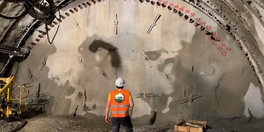
Visual overview
Reference standards
BS 5930:2015+A1:2020 Code of practice for ground investigations, BS EN 1997-1:2004 (Eurocode 7) Geotechnical design, CIRIA C760 Guidance on embedded retaining wall design, BS 5228-2:2009+A1:2014 Noise and vibration control on construction sites
Additional services
Inclinometer & wall deflection monitoring
In-place inclinometer strings installed inside guide tubes attached to the retaining wall or drilled behind the line of the cut. Data is polled automatically and plotted against cumulative excavation depth so the trend is visible at a glance.
Piezometer & groundwater tracking
Vibrating-wire standpipe and fully-grouted piezometers placed in the active and passive zones. We correlate pore-pressure changes with tide, river level, and rainfall to separate seasonal drift from excavation-induced response.
Surface settlement & building damage assessment
Robotic total station arrays on surrounding kerbs, pavements, and building corners, supplemented by manual crack-width gauges on sensitive structures. All readings are mapped onto a 3D displacement model updated daily.
Typical parameters
Top questions
What monitoring does Northampton borough council typically require for a deep basement dig?
Most planning conditions in Northampton follow the recommendations of CIRIA C760 and BS EN 1997-1, which effectively means you need a monitoring plan that covers retained height deflection, ground settlement behind the wall, and groundwater levels if the excavation goes below the water table. The council's building control team will normally ask for a Category 2 or Category 3 check, depending on proximity to neighbouring structures, and they expect to see trigger levels tied to a contingency plan. We have supported several approvals in Northampton by submitting the instrumentation layout alongside the temporary works design, so the regulator can see that the monitoring is not an afterthought.
How quickly can you mobilise a monitoring system on a Northampton site?
For a straightforward urban excavation, we can typically have inclinometer casing and piezometers installed within three to five working days of instruction, assuming the retaining wall is already in place or the boreholes are open. The robotic total station can be running on day one if there are stable reference prisms outside the zone of influence. We keep a stock of vibrating-wire sensors and data loggers in the Midlands, so lead times are short compared to ordering from the continent. The real time-eater is getting the baseline readings agreed with the designer and the client, which we push to complete within the first week so the monitoring is live before the dig goes past the critical first metre.
How much does geotechnical excavation monitoring cost for a typical Northampton project?
For a single-basement residential or small commercial dig in Northampton, the monitoring package usually falls between £580 and £1,790, depending on the number of instruments, the duration of the hire period, and the reporting frequency. A larger cut-and-cover scheme with multiple inclinometer strings, several piezometers, and automated total station tracking will sit at the upper end of that range or slightly beyond if real-time cloud access is required. We quote a fixed monthly rate with no hidden download fees, so you can run the monitoring for as long as the excavation stays open without the cost spiralling.
Can you monitor existing cracks on neighbouring buildings during our Northampton excavation?
Yes, and in Northampton's older terraced streets this is often the single most important part of the monitoring package. We fit LVDT-type crack-width gauges across representative cracks on the party walls and façades of adjacent properties, and we tie those readings into the same alert system that tracks the inclinometers. Before we start, we carry out a condition survey with dated photographs so there is a clear baseline. If a crack opens by more than the agreed trigger—typically 0.5 to 1.0 mm for masonry—the system flags it immediately, and we can correlate the movement with the excavation activity that was happening at that moment.